
Photogrammetric model of the Earl of Orkney’s estate, one example of 3-D assets the Orkney team are gathering as part of their research.
Hard questions abound in the emerging discipline of digital art history. Among them are questions of scale and questions of perspective, which concern the use of 3-D and geospatial analysis in art historical research.
For instance, two places that figure in art historian Jennifer Grayburn and archaeologist Julie Gibson’s research are the towered medieval churches of St. Magnus Kirk on Egilsay (founded in the twelfth century) and St. Magnus Cathedral (founded in 1137) in the Orkney Islands. One church is in ruins, though, while the other still stands in its complete form.

Left: St. Magnus Kirk and graveyard. Photo: Bob Jones. Image is licensed under a Creative Commons Attribution-ShareAlike 2.0 Generic License. Right: St. Magnus Cathedral, Kirkwall, viewed from the Bishop’s Palace. Photo: stevekeiretsu. Image is licensed under a Creative Commons Attribution-ShareAlike 3.0 United States License
Following the martyrdom of the Orkneys’ patron saint in 1117, St. Magnus became a popular figure within a dynamic trading and political network that connected the Orkneys to the rest of the British Islands, Scandinavia, Iceland, and Greenland. Despite this interconnectedness, scholars have mostly researched sites in this network in isolation. Grayburn and Gibson aim to uncover the relationship between the two geographically separated and seemingly unrelated churches and their function as part of a larger cultural landscape. Digital tools play a key role in doing this.
The pair took their project to a two-week workshop this past summer on Advanced Topics in Digital Art History: 3D and (Geo)Spatial Networks, held in Venice, Italy, and funded by the Getty Foundation. Organized by Duke University’s Wired! Lab in collaboration with Venice International University, the workshop was geared towards advanced scholarly research projects, especially those with already established teams.
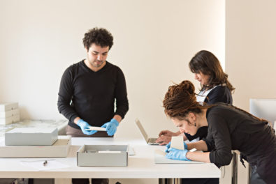
It also tested a new model of participation in digital art history workshops, with art historians accompanied by the visual media scholars, 3-D and virtual reality specialists, historians, librarians, filmmakers, and programmers with whom they collaborate. With nine projects accepted, the seminar produced a heady scholarly debate and encouraged the sharing of information that showed real potential to sustain advanced work in digital art history. For those interested in learning more, conversations are accessible on Twitter with the hashtag #DAHVenice2018.
A New Model for Digital Art History Workshops
Under the leadership of Duke faculty and staff members Victoria Szabo, Hannah Jacobs, Paul Jaskot, Mark Olson, and Edward Triplett, the workshop had three main goals:
- To bring teams together to test and develop specific art historical projects.
- To use discussion of key readings as well as modeling of diverse spatial technologies of visualization and analysis to develop the participants’ projects.
- To develop a workflow model for sustaining their projects into the future.
The projects brought to the workshop by a group of participants from around the world featured a wide range of art historical topics. Along with medieval church architecture in the Orkneys, the researchers focused on topics from the ancient fortifications of the Balkan city of Trogir to early modern Florence to modern-era Istanbul. Reflecting the most developed areas of digital art history, there were strong clusters of topics in the ancient, medieval, and early modern eras, especially when they overlapped with archaeology, a field of long-standing engagement with digital methods.
The group was united by their shared challenge to embrace both the capacities of the digital and the values of the art historian and visual critic, as well as by the “hard questions” of scale and perspective that concern the discipline of digital art history at large.

Workshop participants and instructors celebrate after two intensive weeks of teaching and learning together. Image courtesy Paul Jaskot
Questions of Scale
Grayburn and Gibson’s project, “Modeling Power and Pilgrimage in Medieval Orkney,” reckons with geographic scale as it seeks to analyze the architectural landscape across a chain of scattered islands, in many cases with incomplete physical remains. The team is combining digital methods with material evidence and textual sources such as the Orkneyinga Saga, a literary work on the history of the islands, to reconstruct a large number of sites and gain a more comprehensive understanding of the region’s complex economic and political systems.
For example, digital reconstructions of the two churches that bear St. Magnus’s name have allowed the scholars to confirm they were visible to each other—an important point of connection for the powerful and the pilgrim alike between the “kirk” where the saint purportedly died on Egilsay and the cathedral where he was eventually entombed. Unpacking the art historical significance of such discoveries will follow as the team continues their research.
The DECIMA group’s project also deals with issues of scale, but in terms of data.
Represented at the workshop by Éric Pecile and Hana Suckstorff, the project is recreating a model of Florence from a late sixteenth-century map and by incorporating the data sets of three historic censuses undertaken in Florence between 1551 and 1632—going a step beyond most other digital mapping projects for pre-modern cities that rely only on the record of the built environment of the time.

Screen capture of DECIMA’s interactive exploratory map of historical Florentine data.
The scale of the project is vast. Users of the map can zoom into individual buildings to discover individual data points such as household size or occupation. They can also design queries of the data set that can track changes over time in property value or population across the entire city.
Questions of Perspective
Art historical projects that engage perspective often consider a single object or collection of objects in relation to a particular point of view in space, time, or attitude. An example at the workshop was “Visualizing the Sanctuary at Samothrace,” a collaborative exploration of place and experience led by Bonna Westcoat with Vincent Baillet and Ian Burr.

Screen capture of Visualizing the Sanctuary at Samothrace. Image courtesy Paul Jaskot
The project is gaining a deeper understanding of the sanctuary complex on the Aegean island through a wide variety of digital means, including:
- an interactive plan that traces building development from the late fifth c. B.C. to late first c. A.D.;
- online access to collections of excavated objects;
- high-resolution photography of the current site;
- and even 3-D walk-throughs of the site, like the video reconstruction below that takes the perspective of a pilgrim entering the sanctuary’s threshold gate (the Propylon of Ptolemy II) and continuing into a theatrical complex populated with schematic silhouettes.
The Samothrace project’s concern with issues of embodiment and phenomenology—thinking about how visitors moved through and used the various historical sites under study—were shared by almost every project in the seminar, including “Modeling Movement: Visualization of Inhabited Space.”
Focusing on a building by the famous Ottoman architect Sinan that was repurposed in the nineteenth century as a mental asylum, “Modeling Movement” exemplifies some of the most advanced integration of spatial analysis and computational methods.

Screen captures from the 3-D model in SpatioScholar for the Modeling Movement project. Image courtesy Burcak Ozludil Altin
Scholar Burcak Ozludil is exploring how the space was transformed and how that shift may have not just reflected, but actually enacted new mental health practices in the period. This research question demanded not only deep analysis of architectural plans and photographs, but also attempts to reconstruct how inmates and staff experienced the spaces.
Since there are often few documents that can help flesh out these individual stories—especially of silenced historical groups like mental patients—Ozludil paired up with her colleague Augustus Wendell, who took the lead in developing a spatial platform that helps to model experience.
Reconstructing rituals, movements, and experiences is, of course, critical for many scholars who study the meaning of buildings and art objects that were displayed and experienced in specific spaces. Ozludil and Wendell hope that their platform, SpatioScholar, can be used more widely in art history for spatial analysis.
Questions of perspective can also be extended to the composition of a project team. The “Visualizing the Mount Estate” collaborators are doing just that in their study of an important Qing dynasty (1644–1911) imperial park in Chengde, China. The Bishu shanzhuang, or “Mountain Estate to Escape the Heat,” was constructed over the course of the eighteenth century, encompassed over 250 architectural assemblages at its height, and spread across 3,500 acres—an area more than four times the size of New York City’s Central Park. Yet 200 years of reconstruction and decay now mask its original layout and function.
To recover these aspects and better understand this critical cultural site where emperors entertained, relaxed, and conducted state business as many as seven months out of the year, the team involves multiple scholarly points of view. In addition to the art historical expertise of Stephen Whiteman and the digital technology knowledge of Hedren Sum, Biju Dhanapalan brings filmmaking and storytelling acumen to the project. They are borrowing digital tools and methods from film pre-production, visual effects, and gaming to complement those from geography, art and architectural history, and material culture studies. The outcomes of this novel approach are still to come, but the collaborators expect to develop new ways to engage with and experience dynamic historical environments.

Screen capture of Visualizing the Mountain Estate’s interactive map of the site at Chengde.
Common Threads and Next Steps
For the workshop organizers, the mutual support and interaction among the teams surfaced shared art historical questions at the heart of their projects: How do we understand the human experience of space as part of establishing the meaning of an object or site? How do we analyze the built environment when historical or physical evidence is partial or ambiguous? How do we think about spatial art historical subjects within the context of larger and complex physical and social environments? These three key questions kept returning in our presentations and conversations, and they will undoubtedly continue to inform ongoing research.
The seminar participants will meet again in Venice in June 2019 to present further results of their collaborations. We will also see how our collective conversation about the ways that 3-D and geospatial analysis can enrich the field of art history more broadly has evolved. Members of the organizing team anticipate sharing broader insights and recommendations for the field’s development in writing, at conferences, including the College Art Association meeting in New York in February 2019, and by example in their own 3-D geospatial project work going forward.


This is great! Thank you for writing this up.
This is fascinating and important. My concern is how to promote equity given the imbalance of digital resources and knowledge across the country – and around the world.
This is really wonderful. Could you give the date and time or title of panel at CAA on which this project will be discussed?